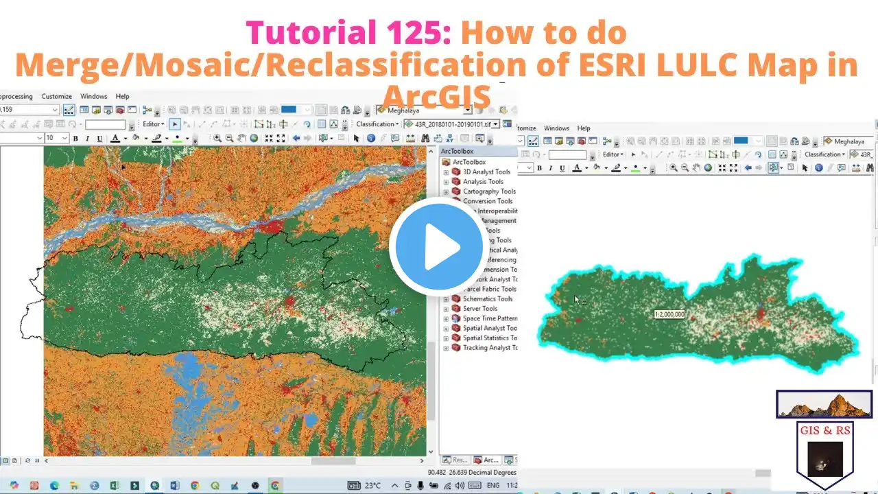
Land Use / Land Cover (LULC) Mapping & Area Calculation with ArcGIS Pro
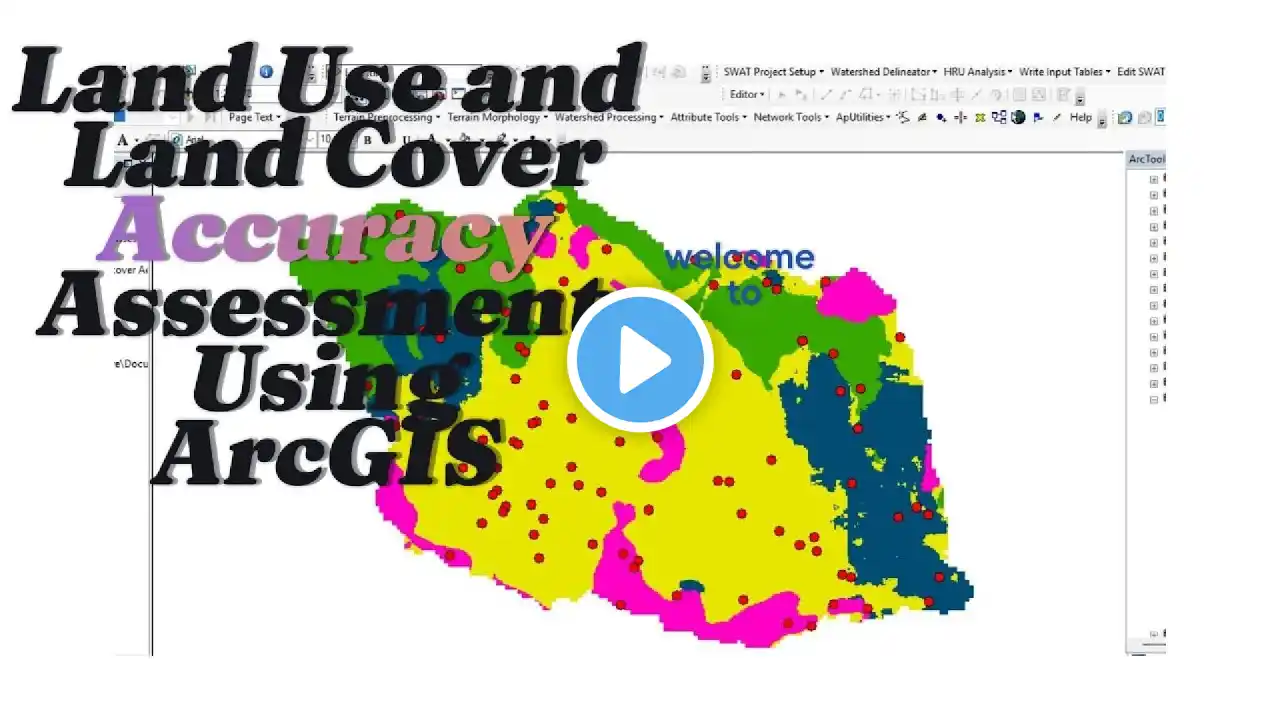
🌍 Unlock the power of spatial analysis with our comprehensive tutorial on "Mastering Land Use/Land Cover Mapping and Area Estimation with ArcGIS Pro"! 🌐 🔍 In this in-depth YouTube tutorial, we dive into the intricacies of ArcGIS Pro, guiding you through the process of creating accurate and insightful land use/land cover maps. Whether you're a GIS enthusiast, environmental scientist, or urban planner, this tutorial is designed to empower you with the skills needed to harness the full potential of ArcGIS Pro for precise area estimation. 🗺️ Key Topics Covered: 1. Introduction to ArcGIS Pro: Familiarize yourself with the ArcGIS Pro interface and essential tools for spatial analysis. 2. Data Acquisition and Preparation: Learn effective techniques for obtaining and preparing diverse datasets for land use/land cover mapping. 3. Image Classification Techniques (Supervised): Explore image classification methods to accurately categorize land cover types from satellite or aerial imagery. 4. Accuracy Assessment: Understand how to assess the accuracy of your land cover maps to ensure reliability. 5. Area Estimation: Master the art of area estimation using advanced tools within ArcGIS Pro. 6. Visualization and Presentation: Discover tips for creating visually appealing maps and presenting your findings effectively. 📈 Why Watch? Practical Insights: Gain hands-on experience with real-world examples and practical exercises. Expert Guidance: Benefit from step-by-step guidance provided by GIS professionals with extensive experience. Problem-Solving: Tackle common challenges encountered in land use/land cover mapping and learn effective problem-solving strategies. 🎓 Who Should Watch? GIS Professionals, Environmental Scientists, Urban Planners, Students and Researchers 🚀 Elevate your GIS skills and join us on a journey to master land use/land cover mapping with ArcGIS Pro. Don't miss out – hit play now and unlock a new realm of spatial analysis expertise! 🔗 🔗 Resources Mentioned: Landsat 8 Data Access: • Download Landsat 8 images from EarthE... Landsat 8 Band Combinations: https://gisgeography.com/landsat-8-ba... ----------------------------------------------------------------- 💰🤝🏻Join Membership to get access to perks & Support us🤝🏻💰 / @terraspatial ----------------------------------------------------------------- 👩💻 Join the Terra Spatial Community: Engage with fellow learners, share your experiences, and get support on our dedicated community forum. 🌐 Stay connected: 📌 Subscribe to our Channel: / @terraspatial. . 📌 Facebook: / terraspatial 📌 Geosuite blog: https://geosuite.blogspot.com/ --------------------------------------------------------------- 👍 👍 If you find this tutorial helpful, don't forget to like, share, and subscribe for more GIS insights and tutorials! 🌐✨ #arcgispro #gis #LandUseMapping #supervised #spatialanalysis #AreaEstimation #mappingtutorial 🌐✨