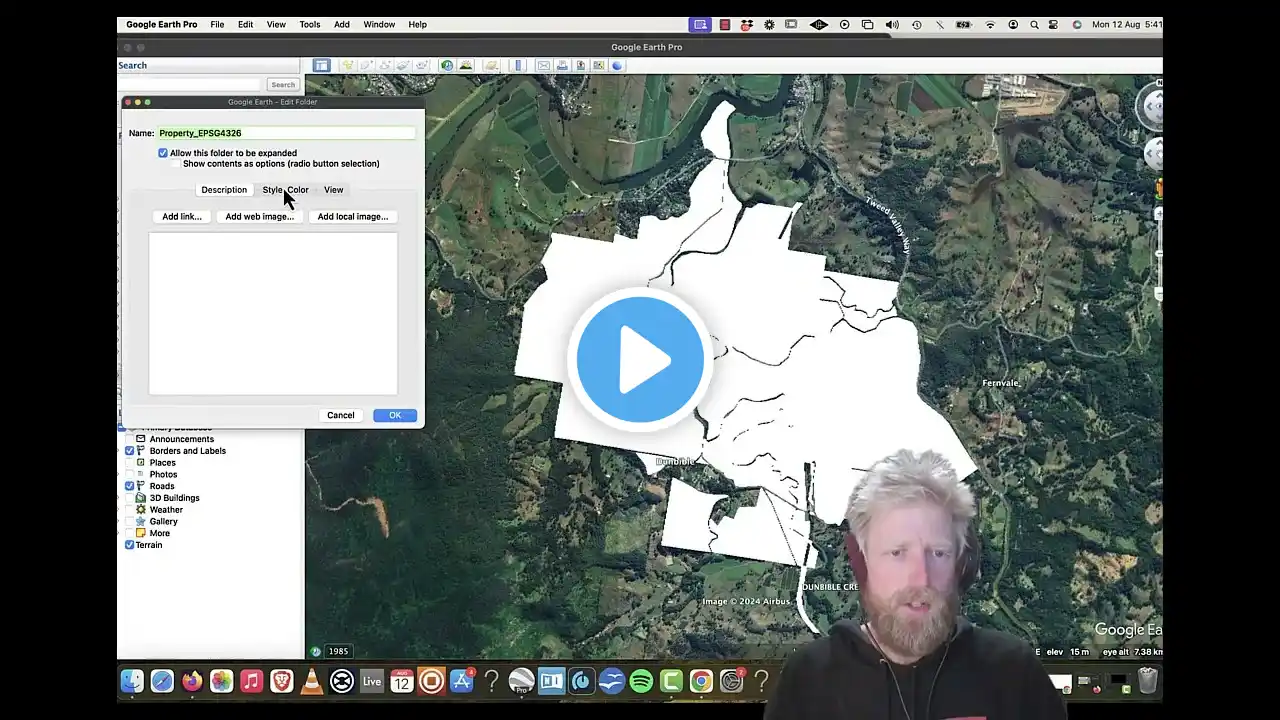
How to Create and Export KML file from Google Earth Pro, kml
Hi- you have taken a time to watch, first thank you for watching this video. Warm welcome all of you on "DIGITAL VIDYA TRAINING PORTAL" it’s a complete learning junction. About me: I am an engineer and designer. so here to teaching and help you for learning. this channel has been created for those who want to learn basic to advance level. besides this you can learn here: 1. Civil 3D Training Tutorial 2.digital marketing 3.online earning and technical education. 4.Autocad 2D/3D 5. google SketchUp like computer/ graphic design and much more. In this video: In this video, we will learn about how to insert google earth image into AutoCAD Civil 3D, besides this we'll discuss how to scale & set the correct alignment. -: For more Query & Contact for Online Professional Training: - What's App - @9560945468 www.digitalvidyatrainng.com /[email protected] Our LIVE Courses - 1. Revit Architecture Professional Training – 2. AutoCAD Advance Training with Working drawing – 3. Sketchup Professional Course with V-Ray 4. Civil 3D Professional Course 5. 3DS MAX with Course - Unlimited Free Video's Playlist - 1. Civil 3d Training – How to import points in AutoCAD civil3D • import survey data into civil 3d | cr... Creating Points using Manual Point Creation in Civil 3D • Avoiding Mistakes: Civil 3D Point Cre... How to Increase and Decrease Point Labels Text Size in Civil 3d • How to Increase and Decrease Point La... Civil 3D Surface Creation • Civil 3D Surface Creation | create su... Civil 3D Tutorial 5: Alignments • Civil 3D Tutorial 5: Alignments | how... How To Create Design profile In AutoCAD Civil 3D • How To Create Design profile In AutoC... Profile Bands in Civil 3D • Profile Bands in Civil 3D | How to Ad... How to Import Points from Notepad TEXT File • How to Import Points from Notepad TEX... how to find difference between 2 surfaces • How to calculate the volume & differe... 2. AutoCAD 2d/3D AutoCAD Tutorials for Beginners- Full play list • AutoCAD Tutorials for Beginners 3.Google SketchUp Full Tutorial- • D5 Render SketchUp Quick Start Guid... 4.Google earth pro- How to import google earth to AutoCAD Civil 3D • Transform Google Earth To AutoCAD Civ... HOW TO IMPORT GOOGLE EARTH IMAGE INTO AUTOCAD CIVIL 3D • How To Import A Google Earth Image In... Our website: - website: -www.digitalvidyatraining.com Our channel: - / @digitalvidyatraining Our digital platform: ------ Facebook page :- Instagram :- LinkedIn :- Keywords - contour from google earth, How to Create and Export KML file from Google Earth Pro, to civil 3d,google earth,how to import surface from google earth to civil 3d using global mapper,insert google earth into autocad,insert google earth image into autocad,google earth data to civil 3d,import google earth data to civil 3d,import elevation data from google earth to civil 3d,google earth to civil 3d,convert google earth to autocad map,civil 3d,autocad civil 3d,civil 3d tutorial,autodesk civil 3d,civil 3d 2017,civil 3d beginner #GoogleEarth #gis #geo #map #geospatial #mapping #geography #spatial #googleearth #googleearthpro #googleearth3d #googleearthsecret #googleearthvideos #google_earth_pro #google_earth